
We left the motel soon after 8:00am. It was drizzling and misty. We were hoping that the mist would clear up soon and so we continued…
Soon the flat, straight stretch of the road was behind us. Ahead, the road was getting steeper and more winding. As we ascended, the fog was getting thicker and thicker and visibility deteriorated drastically by the minutes. We decided to turn back when we could barely see a couple of meters ahead. I felt disappointed and dejected, but safety came first.
Not long after we left the national park region, the drizzle stopped and the sky brightened up. ‘We are going to have a great day after all,’ I thought to myself.
Our first pit stop was Opotaka, the site of the Maori village that was occupied in the 1800s. The second pit stop was Turangi. A small town located on the southern end of Lake Taupo. The town’s main attraction is its excellent trout fishing (on the Tongariro River).
The journey might be long, the road straight and monotonous at times, but it was also along this journey that we were ‘rewarded’ with the spectacular view of New Zealand’s largest lake, Lake Taupo.
Lake Taupo was formed by one of the greatest volcanic explosions of all time. Quote from Lonely Planet under the heading ‘Bang!’:
‘The Taupo region’s really big eruption was about 25,000 years ago – that was the one that actually created the huge basin now filled by Lake Taupo. The eruption produced an estimated 800 cubic kilometres of ash…’
 Opotaka (above and below 3)
 Lake Rotaire

 Turangi – well known for its trout fishing
 Turangi town (above and below)
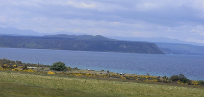
 First sight of Lake Taupo. At 606 sq km,
it is New Zealand’s largest lake. It is also
proclaimed as the world’s largest trout fishing capital.
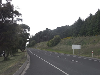 State highway 1, running parallel
to the eastern side of Lake Taupo.
 Lake Taupo (above and below)
 Our packed lunch. It is getting too expensive
to always eat at café or restaurants, so most of the days,
we had packed lunch – economical and save time too.
 More on Lake Taupo view
 Taupo town
 Huka Fall (at Waikato River)
Known as Hukanui in Maori, meaning ‘Great Body of Spray’.
Water is clear and turquoise (above and below 3).


 The journey continued along state highway 5
 View from our motel in Rotorua.
Taken at 8:30pm (above and below).


No comments:
Post a Comment